News
Changes
Suggestions
Problems
Documents
Contributors
Statistics
HOmE
Itineraries
Search by Campsite, Program or Difficulty
Search using a shared key
2025 Itineraries by the numbers
2025 Itineraries at a glance
2025 Itinerary Summary
2025 Programs by Itinerary
Register itinerary for Rendezvous
Virtual Tour
Trek Editor
Activities
Camps
Photos
Photo Albums
Entire Photo Library
Photos needed
Compare
Summary of differences 2025 vs 2024
Compare one Itinerary to any itinerary
Compare one itinerary to all itineraries
Compare Custom Trek to all itineraries
Rendezvous
Register itinerary for Rendezvous
Rendezvous Report
Reports
Interactive Activity Grid
Interactive Campsite Grid
Activity Changes
Campsite Changes
Campsite consistancy
Activity Consistancy
Program Year 2025
Contributions by PUBLIC DOMAIN
Campsites
Off the ranch
On the trail
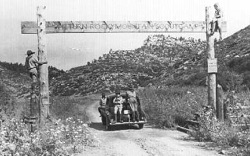
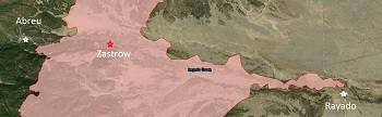
Rayado
Six Mile Gate
Zastrow
Program Features
Infrastructure
Missing Activity
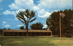
Staff Cabin
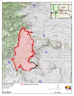
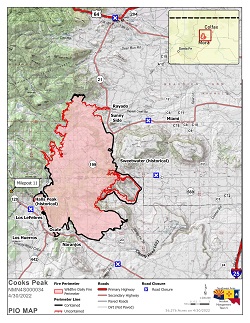
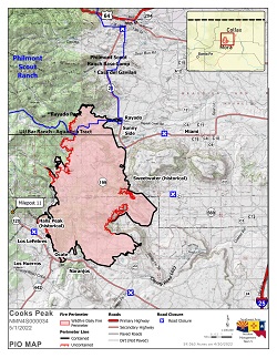
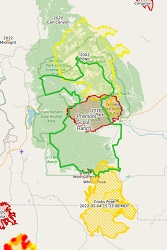
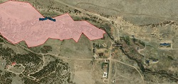
Wildfire